Fasciculus:BelgicaI GermaniaI.jpg
Mensura huius perspectionis: 500 × 600 elementa imaginalia. Aliae mensurae: 200 × 240 elementa imaginalia | 587 × 704 elementa imaginalia.
Sua resolutio (587 × 704 elementa imaginalia, magnitudo fasciculi: 164 chiliocteti, typus MIME: image/jpeg)
Summarium
| Descriptio |
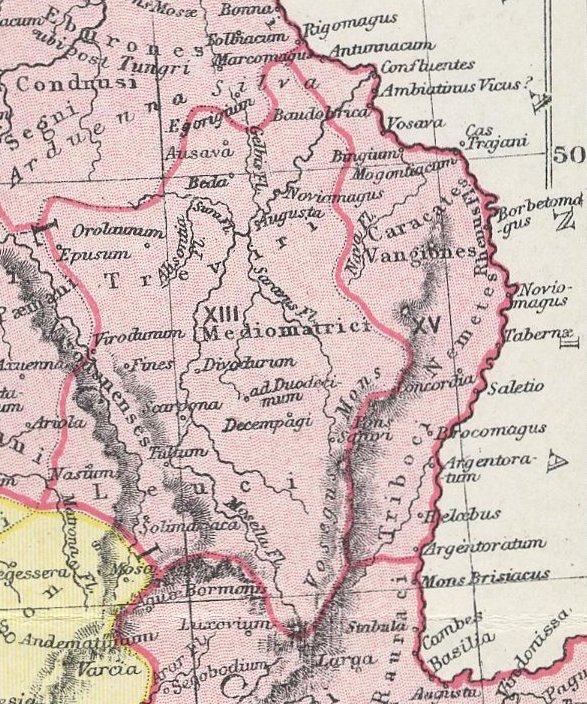
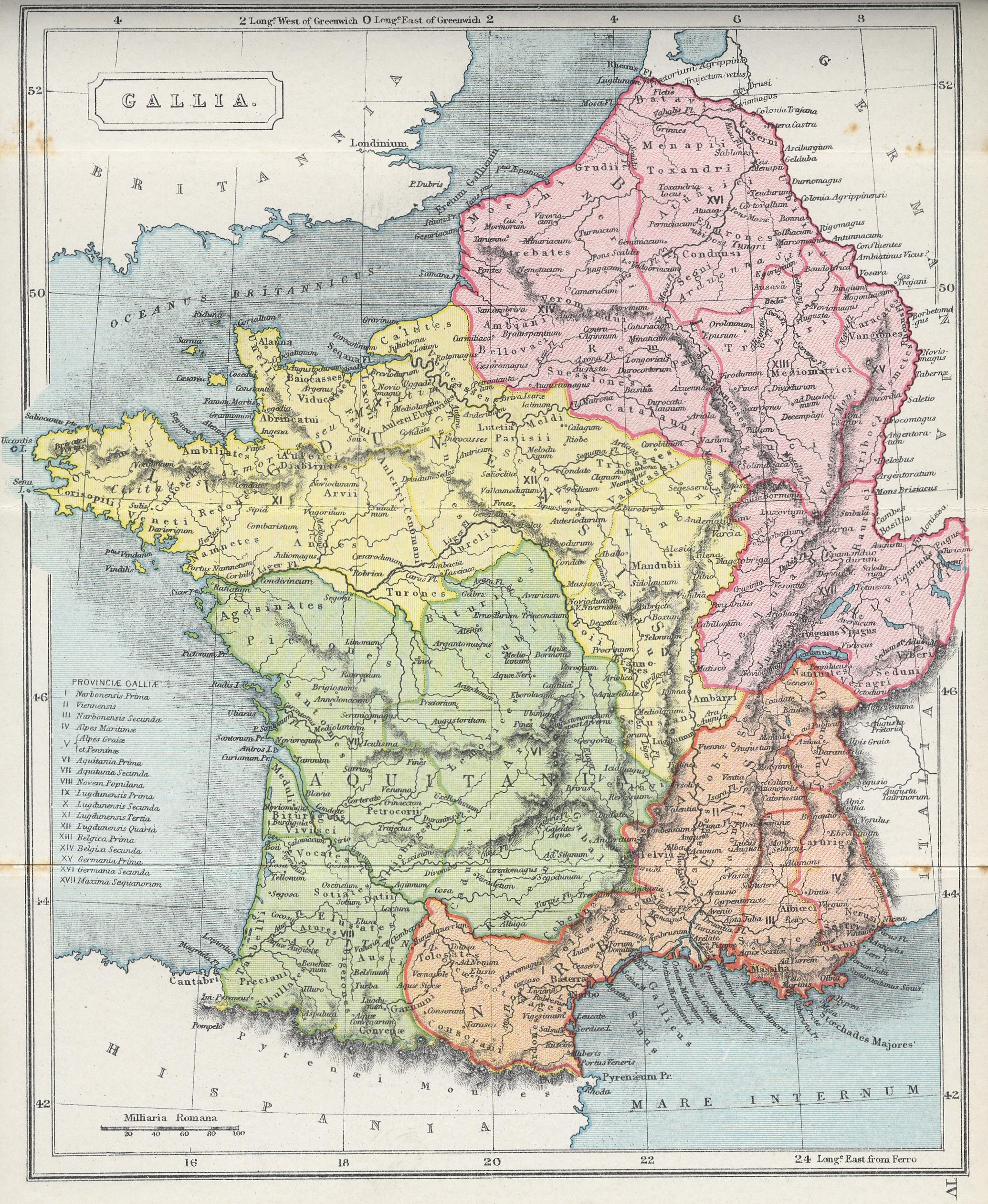
English: A section of the map "GALLIA," from The Atlas of Ancient and Classical Geography showing the late Roman provinces of Germania Prima and Belgica Prima.
Interlingua: Un section del mappa "GALLIA," ex The Atlas of Ancient and Classical Geography monstrante le provincias roman tardive de Germania Prime e Belgica Prime. |
| Datum | |
| Fons | Project Gutenberg: http://www.gutenberg.org/files/17124/17124-h/images/gallia.jpg |
| Auctor | Samuel Butler |
| Other versions | Centrone map.jpg |
Potestas usoris
This media file is in the public domain in the United States. This applies to U.S. works where the copyright has expired, often because its first publication occurred prior to January 1, 1929, and if not then due to lack of notice or renewal. See this page for further explanation.
|
 | |
 |
This image might not be in the public domain outside of the United States; this especially applies in the countries and areas that do not apply the rule of the shorter term for US works, such as Canada, Mainland China (not Hong Kong or Macao), Germany, Mexico, and Switzerland. The creator and year of publication are essential information and must be provided. See Wikipedia:Public domain and Wikipedia:Copyrights for more details.
|
Historia fasciculi
Presso die vel tempore fasciculum videbis, sicut tunc temporis apparuit.
| Dies/Tempus | Minutio | Dimensiones | Usor | Sententia | |
|---|---|---|---|---|---|
| recentissima | 21:19, 27 Februarii 2010 | | 587 × 704 (164 chiliocteti) | QuartierLatin1968 | {{Information |Description={{en|1=A section of the map "GALLIA," from ''The Atlas of Ancient and Classical Geography'' showing the late Roman provinces of Germania Prima and Belgica Prima.}} {{ia|1=Un section del mappa "GALLIA," ex ''The Atlas of Ancient |
Nexus ad fasciculum
Ad hunc fasciculum nectit:
Usus fasciculi per inceptus Vicimediorum
Quae incepta Vici fasciculo utuntur:
- Usus in bg.wikipedia.org
- Usus in ca.wikipedia.org
- Usus in cs.wikipedia.org
- Usus in da.wikipedia.org
- Usus in de.wikipedia.org
- Usus in en.wikipedia.org
- Usus in fr.wikipedia.org
- Usus in fr.wiktionary.org
- Usus in it.wikipedia.org
- Usus in lb.wikipedia.org
- Usus in no.wikipedia.org
- Usus in sr.wikipedia.org