Fasciculus:Poland location map.svg

Size of this PNG preview of this SVG file: 617 × 600 elementa imaginalia. Aliae mensurae: 247 × 240 elementa imaginalia | 494 × 480 elementa imaginalia | 790 × 768 elementa imaginalia | 1 053 × 1 024 elementa imaginalia | 2 107 × 2 048 elementa imaginalia | 861 × 837 elementa imaginalia.
Sua resolutio (fasciculus SVG, nominale 861 × 837 elementa imaginalia, magnitudo fasciculi: 213 chiliocteti)
Summarium
| Descriptio |
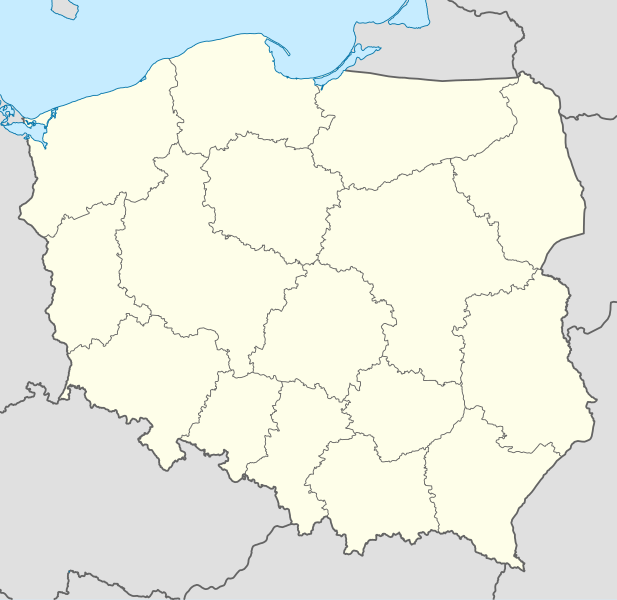
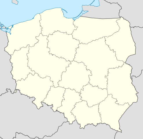
Deutsch: Positionskarte von Polen
Quadratische Plattkarte, N-S-Streckung 160 %. Geographische Begrenzung der Karte:
English: Location map of Poland
Equirectangular projection, N/S stretching 160 %. Geographic limits of the map:
|
||
| Datum | |||
| Fons |
Opus proprium using
|
||
| Auctor | NordNordWest | ||
| Other versions |
|
||
| SVG genesis | This W3C-invalid map was created with Adobe Illustrator.
|


Potestas usoris
I, the copyright holder of this work, hereby publish it under the following licenses:

|
Licet hoc documentum exscribere vel distribuere vel demutare sub GNU Liberarum Litterarum Licentiae conditionibus in editione 1.2 aut in ulla editione recentiori a Fundatione Liberarum Programmationis Partium publicata; praeterquam Sectiones Immutabiles et Verba Involucra Adversa et Aversa. Licentiae exemplar praesto est in sectione intitulata GNU Free Documentation License. |
This file is licensed under the Creative Commons Attribution-Share Alike 3.0 Unported license.
- Tibi licet:
- communicare – copiare, distribuere et committere hoc opus
- to remix – to adapt the work
- His condicionibus:
- attributio – You must give appropriate credit, provide a link to the license, and indicate if changes were made. You may do so in any reasonable manner, but not in any way that suggests the licensor endorses you or your use.
- aequa parte – If you remix, transform, or build upon the material, you must distribute your contributions under the same or compatible license as the original.
Tibi typum permissionis ligere licet.
Historia fasciculi
Presso die vel tempore fasciculum videbis, sicut tunc temporis apparuit.
| Dies/Tempus | Minutio | Dimensiones | Usor | Sententia | |
|---|---|---|---|---|---|
| recentissima | 12:34, 2 Octobris 2012 | | 861 × 837 (213 chiliocteti) | Palosirkka | Reverted to version as of 20:23, 23 November 2011 Location maps must remain very accurate |
| 20:37, 1 Octobris 2012 |  | 861 × 837 (196 chiliocteti) | Palosirkka | Scrubbed with http://codedread.com/scour/ | |
| 20:23, 23 Novembris 2011 |  | 861 × 837 (213 chiliocteti) | NordNordWest | upd | |
| 11:28, 8 Decembris 2008 |  | 862 × 838 (377 chiliocteti) | NordNordWest | Reverted to version as of 09:25, 8 July 2008, an often used image shouldn't be changed without discussion | |
| 09:26, 8 Decembris 2008 |  | 862 × 838 (378 chiliocteti) | Mareklug | I made the featured background (territory of Poland) pure white for better contrast. | |
| 09:25, 8 Iulii 2008 |  | 862 × 838 (377 chiliocteti) | NordNordWest | {{Information |Description= {{de|Positionskarte von Polen}} Quadratische Plattkarte, N-S-Streckung 160 %. Geographische Begrenzung der Karte: * N: 55.2° N * S: 48.7° N * W: 13.8° O * O: 24.5° O {{en|Location map of Poland} |
Nexus ad fasciculum
Nullae paginae hoc fasciculo utuntur.
Usus fasciculi per inceptus Vicimediorum
Quae incepta Vici fasciculo utuntur:
- Usus in ar.wikipedia.org
- Usus in av.wikipedia.org
- Usus in bn.wikipedia.org
- Usus in bs.wikipedia.org
- Usus in ceb.wikipedia.org
- Usus in ckb.wikipedia.org
- Usus in de.wikipedia.org
- Usus in diq.wikipedia.org
- Usus in el.wikipedia.org
- Usus in en.wikipedia.org
- Usus in en.wikivoyage.org
- Usus in en.wiktionary.org
- Usus in eo.wikipedia.org
- Usus in eo.wikivoyage.org
- Usus in es.wikipedia.org
- Usus in fa.wikipedia.org
- Usus in fo.wikipedia.org
- Usus in fr.wikipedia.org
- Usus in hr.wikipedia.org
- Usus in hsb.wikipedia.org
- Usus in hu.wikipedia.org
View more global usage of this file.