Fasciculus:Peloponnese Middle Ages map-en.svg

Size of this PNG preview of this SVG file: 766 × 600 elementa imaginalia. Aliae mensurae: 307 × 240 elementa imaginalia | 613 × 480 elementa imaginalia | 981 × 768 elementa imaginalia | 1 280 × 1 002 elementa imaginalia | 2 560 × 2 005 elementa imaginalia | 1 785 × 1 398 elementa imaginalia.
Sua resolutio (fasciculus SVG, nominale 1 785 × 1 398 elementa imaginalia, magnitudo fasciculi: 2.04 megaocteti)
| Descriptio |
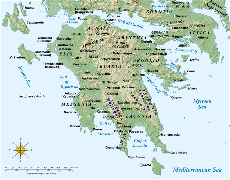
English: Map of Peloponnese, Greece, with the sites of major importance during the Middle Ages.
Français : Carte du Péloponnèse, Grèce, avec principaux sites du Moyen Âge. UTM projection; WGS84 datum |
| Datum | (UTC) |
| Fons | |
| Auctor |
|
| Other versions |
|


| This is a retouched picture, which means that it has been digitally altered from its original version. Modifications: English version, added more sites. The original can be viewed here: Peloponnese Middle Ages map-fr.svg:
|
I, the copyright holder of this work, hereby publish it under the following licenses:
This file is licensed under the Creative Commons Attribution-Share Alike 3.0 Unported, 2.5 Generic, 2.0 Generic and 1.0 Generic license.
- Tibi licet:
- communicare – copiare, distribuere et committere hoc opus
- to remix – to adapt the work
- His condicionibus:
- attributio – You must give appropriate credit, provide a link to the license, and indicate if changes were made. You may do so in any reasonable manner, but not in any way that suggests the licensor endorses you or your use.
- aequa parte – If you remix, transform, or build upon the material, you must distribute your contributions under the same or compatible license as the original.

|
Licet hoc documentum exscribere vel distribuere vel demutare sub GNU Liberarum Litterarum Licentiae conditionibus in editione 1.2 aut in ulla editione recentiori a Fundatione Liberarum Programmationis Partium publicata; praeterquam Sectiones Immutabiles et Verba Involucra Adversa et Aversa. Licentiae exemplar praesto est in sectione intitulata GNU Free Documentation License. |
Tibi typum permissionis ligere licet.
Original upload log
This image is a derivative work of the following images:
- File:Peloponnese_Middle_Ages_map-fr.svg licensed with Cc-by-sa-3.0,2.5,2.0,1.0, GFDL
- 2008-04-07T20:18:41Z Sting 1785x1398 (1175068 Bytes) Bigger labels
- 2008-04-04T20:27:23Z Sting 1785x1398 (1175530 Bytes) {{Information |Description={{en|Map of [[:en:Peloponnese|Peloponnese]], Greece, with major places of the Middle Ages.}} {{fr|Carte du [[:fr:Péloponnèse|Péloponnèse]], Grèce, avec principaux sites du Moyen Âge.}} |Source
Uploaded with derivativeFX
Historia fasciculi
Presso die vel tempore fasciculum videbis, sicut tunc temporis apparuit.
| Dies/Tempus | Minutio | Dimensiones | Usor | Sententia | |
|---|---|---|---|---|---|
| recentissima | 11:02, 24 Februarii 2014 | | 1 785 × 1 398 (2.04 megaocteti) | Cplakidas | various minor tweaks, added approx. location of Grand Magne text to paths |
| 13:35, 17 Augusti 2012 |  | 1 785 × 1 398 (1.16 megaocteti) | Phso2 | Minor changes : typos, anticised modern names in brackets, duplicate Pylos/Navarin | |
| 17:13, 10 Maii 2010 |  | 1 785 × 1 398 (1.16 megaocteti) | Cplakidas | various tweaks with names, added the Hexamilion wall | |
| 10:36, 21 Aprilis 2010 |  | 1 785 × 1 398 (1.16 megaocteti) | Cplakidas | bolded city names to make them more discernible | |
| 10:21, 21 Aprilis 2010 |  | 1 785 × 1 398 (1.15 megaocteti) | Cplakidas | {{Information |Description={{en|Map of Peloponnese, Greece, with the sites of major importance during the Middle Ages.}} {{fr|Carte du Péloponnèse, Grèce, avec principaux sites du Moyen Âge.}}<br/> UTM proje |
Nexus ad fasciculum
Nullae paginae hoc fasciculo utuntur.
Usus fasciculi per inceptus Vicimediorum
Quae incepta Vici fasciculo utuntur:
- Usus in azb.wikipedia.org
- Usus in ca.wikipedia.org
- Usus in cs.wikipedia.org
- Usus in de.wikipedia.org
- Usus in el.wikipedia.org
- Usus in en.wikipedia.org
- Constantine XI Palaiologos
- Principality of Achaea
- Morea
- Lordship of Argos and Nauplia
- Las (Greece)
- Battle of the Olive Grove of Kountouras
- William of Champlitte
- Geoffrey I of Villehardouin
- Skorta
- Nerio I Acciaioli
- Chlemoutsi
- Glarentza
- Ottoman–Venetian War (1463–1479)
- Morea revolt of 1453–1454
- Leo Sgouros
- Ezeritai
- Melingoi
- Battle of Prinitza
- Battle of Makryplagi
- User:Cplakidas/Articles
- Battle of the Echinades (1427)
- Barony of Vostitsa
- Barony of Patras
- Barony of Akova
- Barony of Passavant
- Barony of Geraki
View more global usage of this file.