Fasciculus:China Inner Mongolia relief location map.png

Mensura huius perspectionis: 798 × 600 elementa imaginalia. Aliae mensurae: 320 × 240 elementa imaginalia | 639 × 480 elementa imaginalia | 1 022 × 768 elementa imaginalia | 1 280 × 962 elementa imaginalia | 2 000 × 1 503 elementa imaginalia.
Sua resolutio (2 000 × 1 503 elementa imaginalia, magnitudo fasciculi: 5.72 megaocteti, typus MIME: image/png)
| Descriptio |
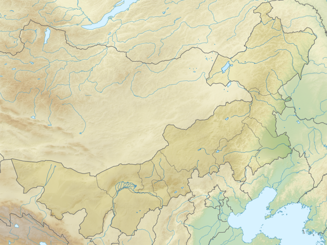
English: Location map of Inner Mongolia, People's Republic of China
Equirectangular projection, N/S stretching 141 %. True scale parallel: 45°00' N. Geographic limits of the map:
|
| Datum | (UTC) |
| Fons | |
| Auctor |
|
| This is a retouched picture, which means that it has been digitally altered from its original version. The original can be viewed here: China Inner Mongolia location map.svg:
|
I, the copyright holder of this work, hereby publish it under the following licenses:
This file is licensed under the Creative Commons Attribution-Share Alike 3.0 Unported license.
- Tibi licet:
- communicare – copiare, distribuere et committere hoc opus
- to remix – to adapt the work
- His condicionibus:
- attributio – You must give appropriate credit, provide a link to the license, and indicate if changes were made. You may do so in any reasonable manner, but not in any way that suggests the licensor endorses you or your use.
- aequa parte – If you remix, transform, or build upon the material, you must distribute your contributions under the same or compatible license as the original.

|
Licet hoc documentum exscribere vel distribuere vel demutare sub GNU Liberarum Litterarum Licentiae conditionibus in editione 1.2 aut in ulla editione recentiori a Fundatione Liberarum Programmationis Partium publicata; praeterquam Sectiones Immutabiles et Verba Involucra Adversa et Aversa. Licentiae exemplar praesto est in sectione intitulata GNU Free Documentation License. |
Tibi typum permissionis ligere licet.
Original upload log
This image is a derivative work of the following images:
- File:China_Inner_Mongolia_location_map.svg licensed with Cc-by-sa-3.0, GFDL
- 2011-02-20T21:56:03Z Das steinerne Herz 577x433 (374280 Bytes) completly new version
- 2011-02-13T19:55:46Z Das steinerne Herz 663x500 (2319654 Bytes) trying to correct
- 2011-02-10T14:14:56Z Das steinerne Herz 664x508 (2319564 Bytes) cropping
- 2011-02-10T08:02:33Z Das steinerne Herz 748x605 (2264902 Bytes) correction
- 2011-02-09T18:54:26Z Das steinerne Herz 748x605 (2273721 Bytes) {{Information |Description ={{en|1=Location map of [[:en:Inner Mongolia|Inner Mongolia]], [[:en:People's Republic of China|People's Republic of China]] Equirectangular projection, N/S stretching 141 %. Geographic limits of
Uploaded with derivativeFX
Historia fasciculi
Presso die vel tempore fasciculum videbis, sicut tunc temporis apparuit.
| Dies/Tempus | Minutio | Dimensiones | Usor | Sententia | |
|---|---|---|---|---|---|
| recentissima | 09:00, 24 Februarii 2011 | | 2 000 × 1 503 (5.72 megaocteti) | Das steinerne Herz | {{Information |Description={{en|1=Location map of Inner Mongolia, People's Republic of China Equirectangular projection, N/S stretching 141 %. True scale parallel: 45°00' N. Geographic limits of t |
Nexus ad fasciculum
Ad hunc fasciculum nectit:
Usus fasciculi per inceptus Vicimediorum
Quae incepta Vici fasciculo utuntur:
- Usus in ar.wikipedia.org
- Usus in ba.wikipedia.org
- Usus in bg.wikipedia.org
- Usus in bn.wikipedia.org
- Usus in ceb.wikipedia.org
- Usus in cv.wikipedia.org
- Usus in de.wikipedia.org
- Usus in en.wikipedia.org
View more global usage of this file.