Fasciculus:Western Sahara relief location map.jpg

Mensura huius perspectionis: 677 × 600 elementa imaginalia. Aliae mensurae: 271 × 240 elementa imaginalia | 542 × 480 elementa imaginalia | 867 × 768 elementa imaginalia | 1 156 × 1 024 elementa imaginalia | 1 472 × 1 304 elementa imaginalia.
Sua resolutio (1 472 × 1 304 elementa imaginalia, magnitudo fasciculi: 232 chiliocteti, typus MIME: image/jpeg)
Summarium
| Camera location | | View this and other nearby images on: OpenStreetMap |
|---|
| Descriptio |
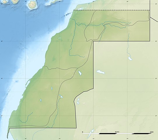
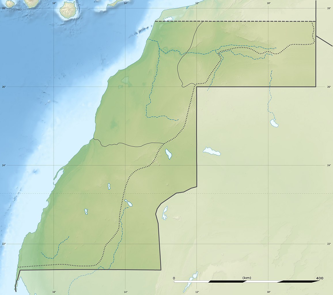
Deutsch: Relief Positionskarte der Westsahara
English: Blank physical map of Western Sahara, for geo-location purposes.
Français : Carte physique vierge du Sahara occidental, destinée à la géolocalisation.
Scale: 1:3,720,000 (precision: 930 m)
Geographic limits of the map:
|
||
| Datum | |||
| Fons |
Opus proprium
|
||
| Auctor | Eric Gaba (Sting - fr:Sting) and user:NordNordWest | ||
| Permissio (Reusing this file) |
|
||
| Other versions |
|


|
This map has been made or improved in the German Kartenwerkstatt (Map Lab). You can propose maps to improve as well.
|
Potestas usoris
I, the copyright holder of this work, hereby publish it under the following licenses:

|
Licet hoc documentum exscribere vel distribuere vel demutare sub GNU Liberarum Litterarum Licentiae conditionibus in editione 1.2 aut in ulla editione recentiori a Fundatione Liberarum Programmationis Partium publicata; praeterquam Sectiones Immutabiles et Verba Involucra Adversa et Aversa. Licentiae exemplar praesto est in sectione intitulata GNU Free Documentation License. |
This file is licensed under the Creative Commons Attribution 3.0 Unported license.
- Tibi licet:
- communicare – copiare, distribuere et committere hoc opus
- to remix – to adapt the work
- His condicionibus:
- attributio – You must give appropriate credit, provide a link to the license, and indicate if changes were made. You may do so in any reasonable manner, but not in any way that suggests the licensor endorses you or your use.
Tibi typum permissionis ligere licet.
Historia fasciculi
Presso die vel tempore fasciculum videbis, sicut tunc temporis apparuit.
| Dies/Tempus | Minutio | Dimensiones | Usor | Sententia | |
|---|---|---|---|---|---|
| recentissima | 13:13, 19 Iulii 2010 | | 1 472 × 1 304 (232 chiliocteti) | Sting | Color profile |
| 19:33, 22 Novembris 2009 |  | 1 472 × 1 304 (230 chiliocteti) | Sting | == {{int:filedesc}} == {{Location|24|27|00|N|12|51|00|W|scale:3000000}} <br/> {{Information |Description={{de|Relief Positionskarte der Westsahara}} {{en|Blank physical map of Western Sahara, for geo-location purp |
Nexus ad fasciculum
Ad hunc fasciculum nectit:
Usus fasciculi per inceptus Vicimediorum
Quae incepta Vici fasciculo utuntur:
- Usus in ar.wikipedia.org
- Usus in arz.wikipedia.org
- Usus in ast.wikipedia.org
- Usus in azb.wikipedia.org
- Usus in be.wikipedia.org
- Usus in bg.wikipedia.org
- Usus in ca.wikipedia.org
- Usus in ceb.wikipedia.org
- Usus in cs.wikipedia.org
- Usus in da.wikipedia.org
- Usus in de.wikipedia.org
- Usus in de.wikivoyage.org
- Usus in el.wikipedia.org
- Usus in en.wikipedia.org
View more global usage of this file.