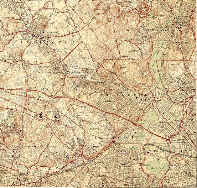
Fasciculus:Topographic maps of Arlington, Belmont, Lexington Massachusetts 1946.jpg

Mensura huius perspectionis: 629 × 600 elementa imaginalia. Aliae mensurae: 252 × 240 elementa imaginalia | 504 × 480 elementa imaginalia | 806 × 768 elementa imaginalia | 1 074 × 1 024 elementa imaginalia | 2 149 × 2 048 elementa imaginalia | 2 560 × 2 440 elementa imaginalia.
Sua resolutio (2 560 × 2 440 elementa imaginalia, magnitudo fasciculi: 2.68 megaocteti, typus MIME: image/jpeg)
Historia fasciculi
Presso die vel tempore fasciculum videbis, sicut tunc temporis apparuit.
| Dies/Tempus | Minutio | Dimensiones | Usor | Sententia | |
|---|---|---|---|---|---|
| recentissima | 20:54, 17 Decembris 2006 |  | 2 560 × 2 440 (2.68 megaocteti) | Daderot | {{Information |Description=Topographic maps of Arlington, Belmont, and Lexington, Massachusetts, as of 1946. Also includes much of Winchester. |Source=USGS 7.5 Minute Series, Lexington, MA Quadrangle, 1946. Surveyed 1943. |Date=1946. |Author=United States |
Nexus ad fasciculum
Ad hunc fasciculum nectit:
Usus fasciculi per inceptus Vicimediorum
Quae incepta Vici fasciculo utuntur:
- Usus in de.wikipedia.org
- Usus in en.wikipedia.org
- Usus in es.wikipedia.org
- Usus in ja.wikipedia.org
- Usus in ro.wikipedia.org
- Usus in ru.wikipedia.org

