Fasciculus:Map of the Kingdom of Galicia, 1914.jpg
Nulla maior resolutio exstat.
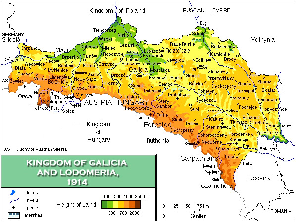
Map_of_the_Kingdom_of_Galicia,_1914.jpg (598 × 450 elementa imaginalia, magnitudo fasciculi: 157 chiliocteti, typus MIME: image/jpeg)
{{DVG|== Summarium ==
| Descriptio |
English: Map of the Kingdom of Galicia, 1914/Mapa fizyczna Galicji 1846-1918 |
| Datum | |
| Fons | Opus proprium |
| Auctor | Mariusz Paździora |
| Other versions | image:Galicia physical1914-de.png German |

|
This historical map image could be re-created using vector graphics as an SVG file. This has several advantages; see Commons:Media for cleanup for more information. If an SVG form of this image is available, please upload it and afterwards replace this template with
{{vector version available|new image name}}.
It is recommended to name the SVG file “Map of the Kingdom of Galicia, 1914.svg”—then the template Vector version available (or Vva) does not need the new image name parameter. |


Potestas usoris
I, the copyright holder of this work, hereby publish it under the following license:
This file is licensed under the Creative Commons Attribution 3.0 Unported license.
- Tibi licet:
- communicare – copiare, distribuere et committere hoc opus
- to remix – to adapt the work
- His condicionibus:
- attributio – You must give appropriate credit, provide a link to the license, and indicate if changes were made. You may do so in any reasonable manner, but not in any way that suggests the licensor endorses you or your use.
Historia fasciculi
Presso die vel tempore fasciculum videbis, sicut tunc temporis apparuit.
| Dies/Tempus | Minutio | Dimensiones | Usor | Sententia | |
|---|---|---|---|---|---|
| recentissima | 07:13, 9 Novembris 2021 | | 598 × 450 (157 chiliocteti) | Alphathon | Corrected Bukovinan and Romanian borders |
| 09:02, 10 Martii 2020 |  | 598 × 450 (310 chiliocteti) | Claude Zygiel | Kingdom of Poland was a part of the Russian Empire, kingdom of Hungary was a part of Austria-Hungary, and Galicia, Bucovina and Austrian Silesia were lands of the Austrian part. | |
| 18:40, 18 Maii 2011 |  | 598 × 450 (193 chiliocteti) | VT | - Slovakia was not present then - Austria-Hungary was changed to Kingdom of Hungary: as the map shows several parts of Austro-Hungarian Monarchy, even Galicia, Bukovina and Austrian Silesia were the parts of it, not just Hungary. | |
| 18:01, 2 Aprilis 2008 |  | 598 × 450 (343 chiliocteti) | Kiejstut9 | {{Information |Description=Map of the Kingdom of Galicia, 1914 |Source=self-made |Date=2008 |Author= Kiejstut9 |Permission= |other_versions= }} |
Nexus ad fasciculum
Ad hunc fasciculum nectit:
Usus fasciculi per inceptus Vicimediorum
Quae incepta Vici fasciculo utuntur:
- Usus in bg.wikipedia.org
- Usus in ca.wikipedia.org
- Usus in da.wikipedia.org
- Usus in de.wikipedia.org
- Usus in el.wikipedia.org
- Usus in en.wikipedia.org
- Usus in es.wikipedia.org
- Usus in et.wikipedia.org
- Usus in eu.wiktionary.org
- Usus in fa.wikipedia.org
- Usus in fr.wikipedia.org
- Usus in gl.wikipedia.org
- Usus in he.wikipedia.org
- Usus in hu.wikipedia.org
- Usus in it.wikipedia.org
- Usus in ja.wikipedia.org
- Usus in mk.wikipedia.org
- Usus in nl.wikipedia.org
- Usus in nn.wikipedia.org
- Usus in no.wikipedia.org
- Usus in pl.wikipedia.org
- Usus in pl.wiktionary.org
- Usus in pt.wikipedia.org
- Usus in ro.wikipedia.org
- Usus in scn.wikipedia.org
- Usus in sh.wikipedia.org
- Usus in sl.wikipedia.org
- Usus in sr.wikipedia.org
- Usus in sv.wikipedia.org
- Usus in yi.wikipedia.org
- Usus in zh.wikipedia.org