Fasciculus:Map of Gulf of Saint Lawrence-No names.png
Mensura huius perspectionis: 673 × 600 elementa imaginalia. Aliae mensurae: 269 × 240 elementa imaginalia | 539 × 480 elementa imaginalia | 862 × 768 elementa imaginalia | 1 059 × 944 elementa imaginalia.
Sua resolutio (1 059 × 944 elementa imaginalia, magnitudo fasciculi: 307 chiliocteti, typus MIME: image/png)
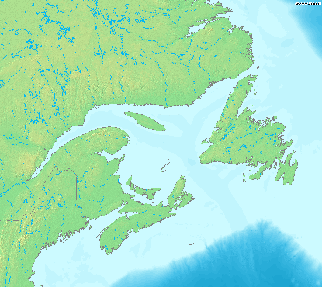
Map of Gulf of Saint Lawrence.
Bounding box West -73°, South 42°, East -51°, North 55°.
This image is in the public domain because it came from the site https://www.demis.nl/products/web-map-server/examples/ and was released by the copyright holder. Permission is granted to copy, distribute and/or modify this map since it is based on free of copyright images from: www.demis.nl. See also approval email on de.wp and its clarification.
|
| This work has been released into the public domain by its copyright holder, www.demis.nl. This applies worldwide. In some countries this may not be legally possible; if so: www.demis.nl grants anyone the right to use this work for any purpose, without any conditions, unless such conditions are required by law.
|
Historia fasciculi
Presso die vel tempore fasciculum videbis, sicut tunc temporis apparuit.
| Dies/Tempus | Minutio | Dimensiones | Usor | Sententia | |
|---|---|---|---|---|---|
| recentissima | 18:17, 15 Octobris 2005 | | 1 059 × 944 (307 chiliocteti) | Mats Halldin~commonswiki | Map of Gulf of Saint Lawrence. Bounding box West -73°, South 42°, East -51°, North 55°. {{demis-pd}} Category:Maps of Canada |
Nexus ad fasciculum
Ad hunc fasciculum nectit:
Usus fasciculi per inceptus Vicimediorum
Quae incepta Vici fasciculo utuntur:
- Usus in en.wikipedia.org
- Usus in es.wikipedia.org
- Usus in fr.wikipedia.org
- Usus in gl.wikipedia.org
- Usus in it.wikipedia.org