Fasciculus:Mali.A2001291.1045.250m.jpg

Mensura huius perspectionis: 800 × 600 elementa imaginalia. Aliae mensurae: 320 × 240 elementa imaginalia | 640 × 480 elementa imaginalia | 1 024 × 768 elementa imaginalia | 1 280 × 960 elementa imaginalia | 2 560 × 1 920 elementa imaginalia | 4 000 × 3 000 elementa imaginalia.
Sua resolutio (4 000 × 3 000 elementa imaginalia, magnitudo fasciculi: 1.75 megaocteti, typus MIME: image/jpeg)
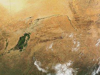
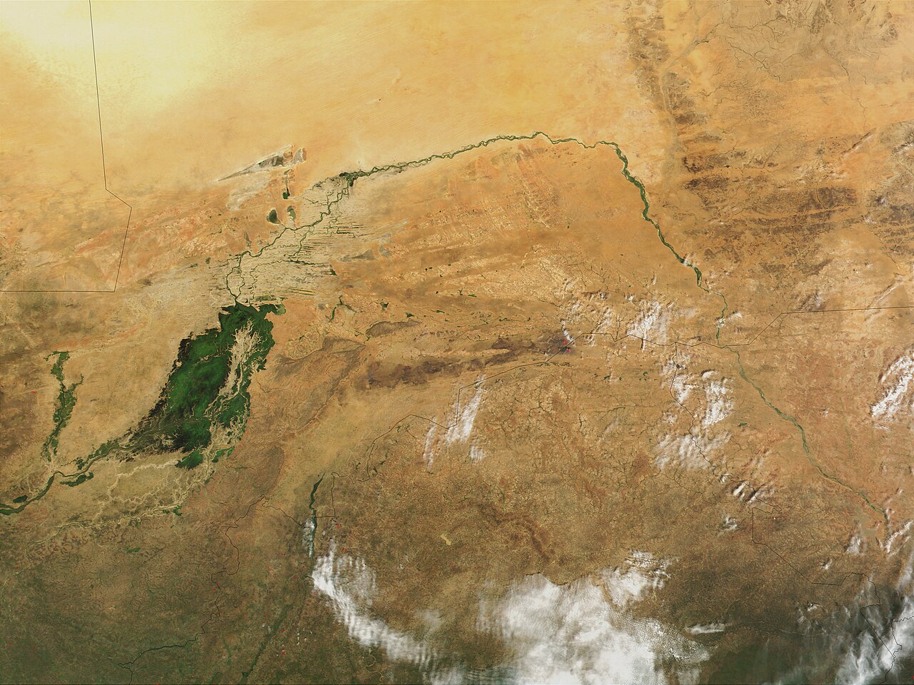
| Descriptio | Niger River in Mali, 2001. Just south of the Sahara Desert in Africa, the Niger River creates a lush area of wetlands and lakes in an otherwise arid environment. In this true-color MODIS image from October 18, 2001, the Niger enters at left as a thin strip of green and flows northeast through Mali. The river then turns south and heads into the country of Niger. (Note, this is at the end of the rainy season, showing the Niger Inland Delta in dark green). | |||||
| Datum |
Visualization Date 2001-10-18 |
|||||
| Fons | http://veimages.gsfc.nasa.gov/2243/Mali.A2001291.1045.250m.jpg | |||||
| Auctor | Jacques Descloitres, MODIS Land Rapid Response Team, NASA/GSFC | |||||
| Permissio (Reusing this file) |
PD, US Gov
|

Historia fasciculi
Presso die vel tempore fasciculum videbis, sicut tunc temporis apparuit.
| Dies/Tempus | Minutio | Dimensiones | Usor | Sententia | |
|---|---|---|---|---|---|
| recentissima | 22:43, 8 Martii 2008 | | 4 000 × 3 000 (1.75 megaocteti) | T L Miles | {{Information |Description=Niger River in Mali, 2001. Just south of the Sahara Desert in Africa, the Niger River creates a lush area of wetlands and lakes in an otherwise arid environment. In this true-color MODIS image from October 18, 2001, the Niger en |
Nexus ad fasciculum
Ad hunc fasciculum nectit:
Usus fasciculi per inceptus Vicimediorum
Quae incepta Vici fasciculo utuntur:
- Usus in af.wikipedia.org
- Usus in as.wikipedia.org
- Usus in bg.wikipedia.org
- Usus in ca.wikipedia.org
- Usus in cy.wikipedia.org
- Usus in en.wikipedia.org
- Usus in eo.wikipedia.org
- Usus in fr.wikipedia.org
- Usus in ilo.wikipedia.org
- Usus in ja.wikipedia.org
- Usus in no.wikipedia.org
- Usus in oc.wikipedia.org
- Usus in pt.wikipedia.org
- Usus in sr.wikipedia.org
- Usus in sv.wikipedia.org
- Usus in sw.wikipedia.org
- Usus in ta.wikipedia.org
- Usus in uk.wikipedia.org
- Usus in zh.wikipedia.org