Fasciculus:Lower Egypt ancient nomes position map.jpg
Nulla maior resolutio exstat.
Lower_Egypt_ancient_nomes_position_map.jpg (564 × 249 elementa imaginalia, magnitudo fasciculi: 28 chiliocteti, typus MIME: image/jpeg)
Summarium
| Descriptio |
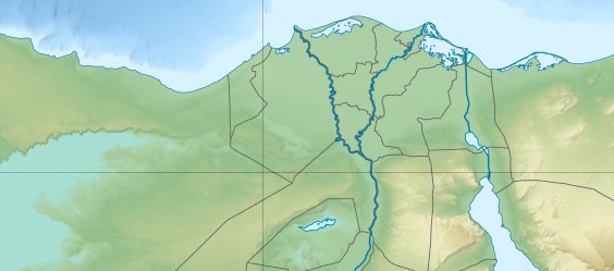
English: Location map of Lower Egypt Topographic scale: 1:4,932,000 (precision: 1,233 m) Equirectangular projection, WGS84 datum *Standard meridian: 030° 45' E *Central parallel: 26° 42' N Geographic limits of the map: * Top: 31° 45' N * Bottom: 29° 00' N * Left: 027° 00' E * Right: 034° 00' E |
| Datum | (UTC) |
| Fons | |
| Auctor |
|
| This is a retouched picture, which means that it has been digitally altered from its original version. Modifications: Extracted the Lower Egypt area. The original can be viewed here: Egypt relief location map.jpg:
|
I, the copyright holder of this work, hereby publish it under the following licenses:
This file is licensed under the Creative Commons Attribution-Share Alike 3.0 Unported license.
- Tibi licet:
- communicare – copiare, distribuere et committere hoc opus
- to remix – to adapt the work
- His condicionibus:
- attributio – You must give appropriate credit, provide a link to the license, and indicate if changes were made. You may do so in any reasonable manner, but not in any way that suggests the licensor endorses you or your use.
- aequa parte – If you remix, transform, or build upon the material, you must distribute your contributions under the same or compatible license as the original.

|
Licet hoc documentum exscribere vel distribuere vel demutare sub GNU Liberarum Litterarum Licentiae conditionibus in editione 1.2 aut in ulla editione recentiori a Fundatione Liberarum Programmationis Partium publicata; praeterquam Sectiones Immutabiles et Verba Involucra Adversa et Aversa. Licentiae exemplar praesto est in sectione intitulata GNU Free Documentation License. |
Tibi typum permissionis ligere licet.
Original upload log
This image is a derivative work of the following images:
- File:Egypt_relief_location_map.jpg licensed with Cc-by-sa-3.0, GFDL
- 2011-04-18T13:59:05Z Sting 1055x975 (424455 Bytes) Updated after Governorats dissolution
- 2010-07-19T13:30:06Z Sting 1055x973 (462160 Bytes) Color profile
- 2010-03-07T19:04:48Z Sting 1055x973 (461278 Bytes) == {{int:filedesc}} == {{Location|26|42|00|N|30|45|00|E|scale:10000000}} {{Information |Description= {{de|Relief Positionskarte von [[:de:Ägypten|Ägypten]]}} {{en|Physical location map of [[:en:Egypt|Egypt]].}} {{fr|Carte
Uploaded with derivativeFX
Historia fasciculi
Presso die vel tempore fasciculum videbis, sicut tunc temporis apparuit.
| Dies/Tempus | Minutio | Dimensiones | Usor | Sententia | |
|---|---|---|---|---|---|
| recentissima | 20:31, 19 Iunii 2011 | | 564 × 249 (28 chiliocteti) | Bogomolov.PL | {{Information |Description={{en|Location map of Lower Egypt <br/> Topographic scale: 1:4,932,000 (precision: 1,233 m)<br/> Equirectangular projection, WGS84 datum<br/> *Standard meridian: 030° 45' E<br/> *Central parallel: 26° 42' N |
Nexus ad fasciculum
Ad hunc fasciculum nectit:
Usus fasciculi per inceptus Vicimediorum
Quae incepta Vici fasciculo utuntur:
- Usus in azb.wikipedia.org
- Usus in bh.wikipedia.org
- Usus in bn.wikipedia.org
- Usus in en.wikipedia.org
- Battle of the Nile
- Pyramid of Djoser
- Suez
- Pyramid of Unas
- Pyramid of Neferirkare
- Battle of Heliopolis
- Pyramid of Sahure
- Pyramid of Neferefre
- Pyramid of Pepi I
- Pyramid of Djedkare Isesi
- Environmental issues in Egypt
- Haïm Capoussi Synagogue
- El Kurdi
- Headless Pyramid
- Module:Location map/data/Lower Egypt/doc
- User:Maggie39/sandbox
- Unfinished Pyramid of Abusir
- User:Archaeobuf/sandbox/hyksos
- Pyramid of Nyuserre
- Module:Location map/data/Lower Egypt
- Fatimid invasion of Egypt (914–915)
- Fatimid invasion of Egypt (919–921)
- Fatimid conquest of Egypt
- Lepsius L
- Usus in es.wikipedia.org
- Usus in fa.wikipedia.org
- Usus in id.wikipedia.org
- Usus in ja.wikipedia.org
View more global usage of this file.