Fasciculus:Kuk New Guinea 2002.jpg

Mensura huius perspectionis: 758 × 600 elementa imaginalia. Aliae mensurae: 303 × 240 elementa imaginalia | 607 × 480 elementa imaginalia | 971 × 768 elementa imaginalia | 1 280 × 1 013 elementa imaginalia | 2 560 × 2 026 elementa imaginalia | 2 664 × 2 108 elementa imaginalia.
Sua resolutio (2 664 × 2 108 elementa imaginalia, magnitudo fasciculi: 1.27 megaocteti, typus MIME: image/jpeg)
Summarium
| Descriptio |
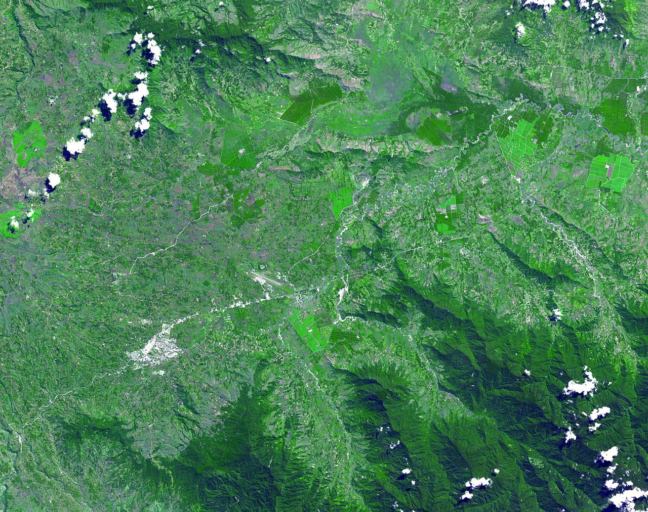
English: The Kuk Early Agricultural Site consists of 116 ha of swamps in the western highlands of New Guinea 1,500 meters above sea-level. Archaeological excavation has revealed the landscape to be one of wetland reclamation worked almost continuously for 7,000, and possibly for 10,000 years. The area was declared a UNESCO World Heritage Site in 2008. The image was acquired May 7, 2002, covers an area of 31.6 x 40 km, and is located at 5.8° S, 144.3° E. |
| Datum | |
| Fons | http://photojournal.jpl.nasa.gov/catalog/PIA13090 |
| Auctor | NASA: JPL |
Potestas usoris
| This file is in the public domain in the United States because it was solely created by NASA. NASA copyright policy states that "NASA material is not protected by copyright unless noted". (See Template:PD-USGov, NASA copyright policy page or JPL Image Use Policy.) | ||
 |
Warnings:
|
Historia fasciculi
Presso die vel tempore fasciculum videbis, sicut tunc temporis apparuit.
| Dies/Tempus | Minutio | Dimensiones | Usor | Sententia | |
|---|---|---|---|---|---|
| recentissima | 02:54, 20 Maii 2010 | | 2 664 × 2 108 (1.27 megaocteti) | Elekhh | {{Information |Description={{en|1=The Kuk Early Agricultural Site consists of 116 ha of swamps in the western highlands of New Guinea 1,500 meters above sea-level. Archaeological excavation has revealed the landsca |
Nexus ad fasciculum
Ad hunc fasciculum nectit:
Usus fasciculi per inceptus Vicimediorum
Quae incepta Vici fasciculo utuntur:
- Usus in af.wikipedia.org
- Usus in ar.wikipedia.org
- Usus in ast.wikipedia.org
- Usus in be.wikipedia.org
- Usus in ca.wikipedia.org
- Usus in cs.wikipedia.org
- Usus in de.wikipedia.org
- Usus in de.wikivoyage.org
- Usus in en.wikipedia.org
- Usus in es.wikipedia.org
- Usus in fa.wikipedia.org
- Usus in fr.wikipedia.org
- Usus in fr.wikivoyage.org
- Usus in gl.wikipedia.org
- Usus in he.wikipedia.org
- Usus in he.wikivoyage.org
- Usus in hr.wikipedia.org
- Usus in hy.wikipedia.org
- Usus in id.wikipedia.org
- Usus in it.wikipedia.org
- Usus in it.wikivoyage.org
- Usus in ja.wikipedia.org
- Usus in ka.wikipedia.org
- Usus in kk.wikipedia.org
- Usus in lt.wikipedia.org
- Usus in lv.wikipedia.org
- Usus in mt.wikipedia.org
View more global usage of this file.