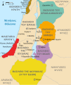
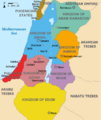
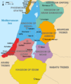
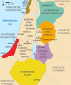
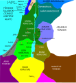
Fasciculus:Kingdoms of Israel and Judah map 830.svg

Size of this PNG preview of this SVG file: 502 × 599 elementa imaginalia. Aliae mensurae: 201 × 240 elementa imaginalia | 402 × 480 elementa imaginalia | 644 × 768 elementa imaginalia | 858 × 1 024 elementa imaginalia | 1 717 × 2 048 elementa imaginalia | 720 × 859 elementa imaginalia.
Sua resolutio (fasciculus SVG, nominale 720 × 859 elementa imaginalia, magnitudo fasciculi: 96 chiliocteti)
Historia fasciculi
Presso die vel tempore fasciculum videbis, sicut tunc temporis apparuit.
| Dies/Tempus | Minutio | Dimensiones | Usor | Sententia | |
|---|---|---|---|---|---|
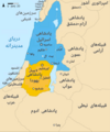
| recentissima | 14:12, 1 Octobris 2021 |  | 720 × 859 (96 chiliocteti) | Sadopaul | File uploaded using svgtranslate tool (https://svgtranslate.toolforge.org/). Added translation for ko. |
| 15:50, 10 Februarii 2017 |  | 720 × 859 (80 chiliocteti) | Malus Catulus | removed 'Sizu' - a weird artifact from the Norse original | |
| 23:48, 12 Februarii 2011 |  | 720 × 859 (78 chiliocteti) | Malus Catulus | - | |
| 11:29, 13 Iulii 2010 | 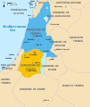 | 720 × 859 (79 chiliocteti) | Malus Catulus | Fixed Judah color | |
| 10:51, 13 Iulii 2010 |  | 720 × 859 (79 chiliocteti) | Malus Catulus | Added colors for the two kingdoms and converted their text to path and arial | |
| 23:53, 12 Iulii 2010 |  | 720 × 859 (62 chiliocteti) | Malus Catulus | Shrinked down the borders | |
| 19:43, 12 Iulii 2010 |  | 720 × 859 (62 chiliocteti) | Malus Catulus | {{Information |Description={{en|1=Map showing the ancient levant borders and ancient cities such as Urmomium and Jerash. The map also shows the region in the 9th century BCE. Notice the coastal land of Philistia, from which the name "Palestine |
Nexus ad fasciculum
Ad hunc fasciculum nectit:
Usus fasciculi per inceptus Vicimediorum
Quae incepta Vici fasciculo utuntur:
- Usus in af.wikipedia.org
- Usus in als.wikipedia.org
- Usus in arz.wikipedia.org
- Usus in azb.wikipedia.org
- Usus in az.wikipedia.org
- Usus in be-tarask.wikipedia.org
- Usus in be.wikipedia.org
- Usus in bg.wikipedia.org
- Usus in bn.wikipedia.org
- Usus in br.wikipedia.org
- Usus in bs.wikipedia.org
- Usus in bxr.wikipedia.org
- Usus in ca.wikipedia.org
- Usus in cdo.wikipedia.org
- Usus in cs.wikipedia.org
- Usus in da.wikipedia.org
- Usus in de.wikipedia.org
- Usus in de.wikibooks.org
- Usus in en.wikipedia.org
View more global usage of this file.

