Fasciculus:Europe mediterranean 1190.jpg

Mensura huius perspectionis: 760 × 600 elementa imaginalia. Aliae mensurae: 304 × 240 elementa imaginalia | 608 × 480 elementa imaginalia | 973 × 768 elementa imaginalia | 1 280 × 1 010 elementa imaginalia | 2 293 × 1 810 elementa imaginalia.
Sua resolutio (2 293 × 1 810 elementa imaginalia, magnitudo fasciculi: 834 chiliocteti, typus MIME: image/jpeg)
Summarium
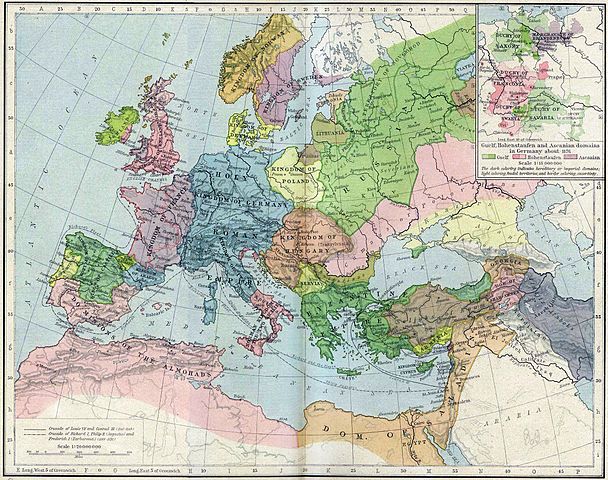
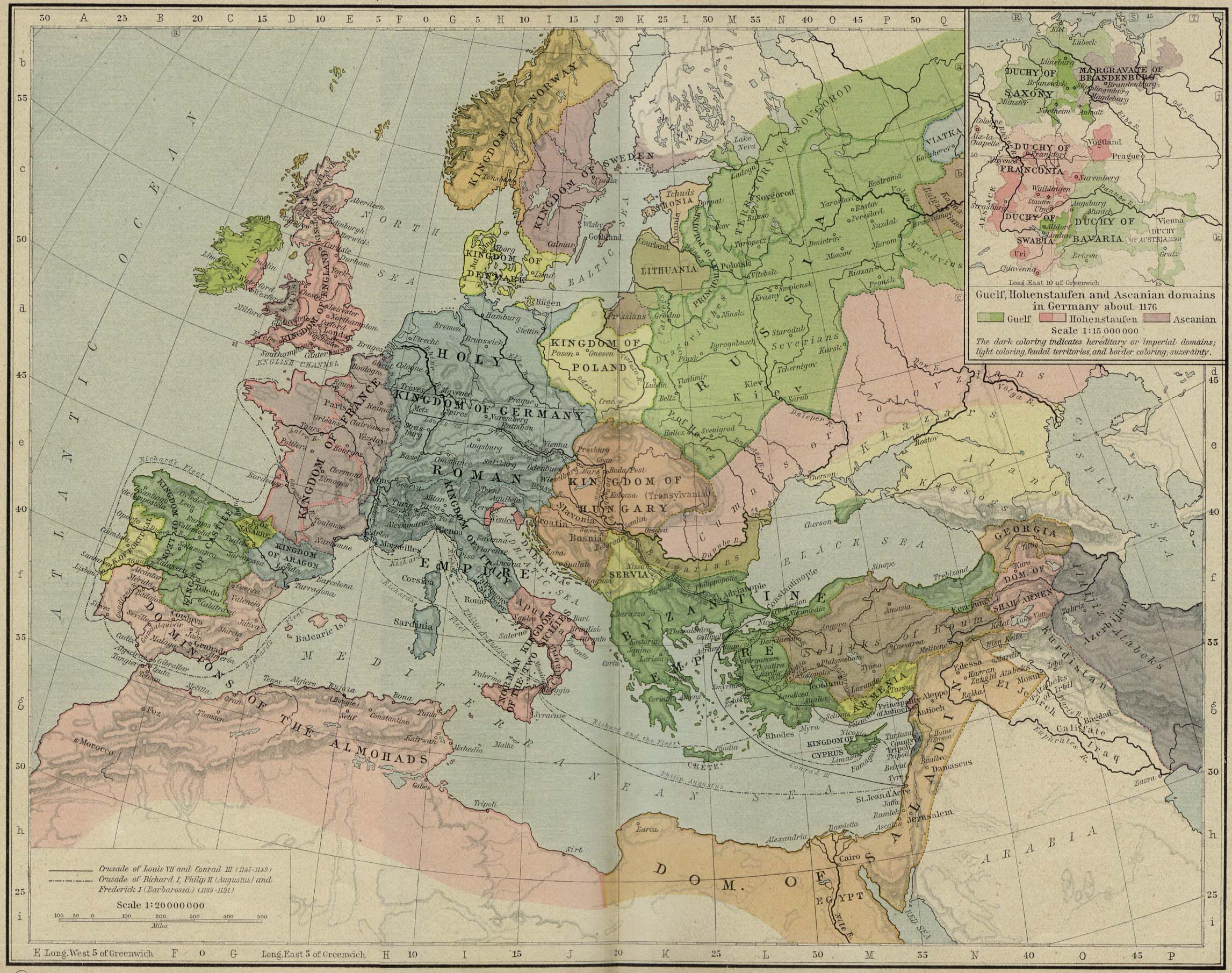
| Descriptio | Europa en 1190. |
| Datum | |
| Fons | Perry-Castañeda Library, Map Collection: From the "Historical Atlas" by William R. Shepherd, New York, Henry Holt and Company, 1923 |
| Auctor | Roke |
| Other versions | العربيَّة |
.jpg)
.jpg)
_en.png)
.png)
.jpg)
Potestas usoris
|
This work is in the public domain in its country of origin and other countries and areas where the copyright term is the author's life plus 70 years or fewer. This work is in the public domain in the United States because it was published (or registered with the U.S. Copyright Office) before January 1, 1929. | |
| This file has been identified as being free of known restrictions under copyright law, including all related and neighboring rights. | |
Historia fasciculi
Presso die vel tempore fasciculum videbis, sicut tunc temporis apparuit.
| Dies/Tempus | Minutio | Dimensiones | Usor | Sententia | |
|---|---|---|---|---|---|
| recentissima | 15:46, 28 Maii 2011 | | 2 293 × 1 810 (834 chiliocteti) | Reddi~commonswiki | |
| 10:30, 8 Maii 2006 |  | 2 293 × 1 810 (667 chiliocteti) | Roke~commonswiki | Europe in 1190 {{Europe}} {{PD-PCL|http://www.lib.utexas.edu/maps/historical/shepherd/europe_mediterranean_1190.jpg}} Category: Historical maps of Europe |
Nexus ad fasciculum
Ad hunc fasciculum nectit:
Usus fasciculi per inceptus Vicimediorum
Quae incepta Vici fasciculo utuntur:
- Usus in azb.wikipedia.org
- Usus in az.wikipedia.org
- Usus in ca.wikipedia.org
- Usus in cs.wikipedia.org
- Usus in cy.wikipedia.org
- Usus in da.wikipedia.org
- Usus in de.wikipedia.org
- Usus in el.wikipedia.org
- Usus in en.wikipedia.org
- Usus in en.wikibooks.org
- Usus in eo.wikipedia.org
- Usus in es.wikipedia.org
- Usus in et.wikipedia.org
- Usus in fa.wikipedia.org
View more global usage of this file.