Fasciculus:Croatia location map.svg

Size of this PNG preview of this SVG file: 619 × 599 elementa imaginalia. Aliae mensurae: 248 × 240 elementa imaginalia | 496 × 480 elementa imaginalia | 793 × 768 elementa imaginalia | 1 058 × 1 024 elementa imaginalia | 2 116 × 2 048 elementa imaginalia | 1 097 × 1 062 elementa imaginalia.
Sua resolutio (fasciculus SVG, nominale 1 097 × 1 062 elementa imaginalia, magnitudo fasciculi: 480 chiliocteti)
Summarium
| Descriptio |
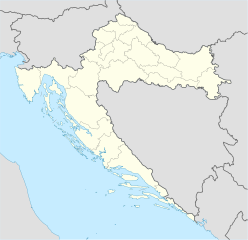
Deutsch: Positionskarte von Kroatien
Quadratische Plattkarte, N-S-Streckung 140 %. Geographische Begrenzung der Karte:
English: Location map of Croatia
Equirectangular projection, N/S stretching 140 %. Geographic limits of the map:
|
| Datum | |
| Fons | own work, using United States National Imagery and Mapping Agency data |
| Auctor | NordNordWest |
| Other versions |
Derivative works of this file: |

|
This map has been made or improved in the German Kartenwerkstatt (Map Lab). You can propose maps to improve as well.
|
Potestas usoris
I, the copyright holder of this work, hereby publish it under the following licenses:

|
Licet hoc documentum exscribere vel distribuere vel demutare sub GNU Liberarum Litterarum Licentiae conditionibus in editione 1.2 aut in ulla editione recentiori a Fundatione Liberarum Programmationis Partium publicata; praeterquam Sectiones Immutabiles et Verba Involucra Adversa et Aversa. Licentiae exemplar praesto est in sectione intitulata GNU Free Documentation License. |
This file is licensed under the Creative Commons Attribution-Share Alike 3.0 Unported license.
- Tibi licet:
- communicare – copiare, distribuere et committere hoc opus
- to remix – to adapt the work
- His condicionibus:
- attributio – You must give appropriate credit, provide a link to the license, and indicate if changes were made. You may do so in any reasonable manner, but not in any way that suggests the licensor endorses you or your use.
- aequa parte – If you remix, transform, or build upon the material, you must distribute your contributions under the same or compatible license as the original.
Tibi typum permissionis ligere licet.
Historia fasciculi
Presso die vel tempore fasciculum videbis, sicut tunc temporis apparuit.
| Dies/Tempus | Minutio | Dimensiones | Usor | Sententia | |
|---|---|---|---|---|---|
| recentissima | 08:00, 29 Augusti 2008 | | 1 097 × 1 062 (480 chiliocteti) | NordNordWest | |
| 15:54, 30 Iulii 2008 |  | 548 × 531 (412 chiliocteti) | NordNordWest | more detailed borderlines | |
| 16:55, 16 Iulii 2008 |  | 548 × 531 (454 chiliocteti) | NordNordWest | {{Information |Description= {{de|Positionskarte von Kroatien}} Quadratische Plattkarte, N-S-Streckung 140 %. Geographische Begrenzung der Karte: * N: 46.8° N * S: 42.1° N * W: 13.1° O * O: 19.9° O {{en|Location map of [[:en:Croatia|Cr |
Nexus ad fasciculum
Ad hunc fasciculum nectunt:
Usus fasciculi per inceptus Vicimediorum
Quae incepta Vici fasciculo utuntur:
- Usus in ab.wikipedia.org
- Usus in af.wikipedia.org
- Usus in als.wikipedia.org
- Usus in am.wikipedia.org
- Usus in an.wikipedia.org
- Usus in ar.wikipedia.org
- قالب:خريطة مواقع
- قالب:خريطة مواقع كرواتيا
- قالب:خريطة مواقع/شرح
- بطولة أوروبا لكرة الصالات 2012
- قالب:خريطة مواقع/ملعب
- قالب:Location map/sandbox quick/doc
- وحدة:Location map/data/Croatia
- وحدة:Location map/data/Croatia/شرح
- اشتباك باكراتش
- حادثة بحيرات بليتفيتش
- معركة بوروفو سيلو
- حصار كييفو (1991)
- عملية العاصفة (حرب البوسنة والهرسك)
- Usus in arz.wikipedia.org
- Usus in ast.wikipedia.org
View more global usage of this file.