Fasciculus:Corse region relief location map.jpg

Mensura huius perspectionis: 304 × 600 elementa imaginalia. Aliae mensurae: 121 × 240 elementa imaginalia | 243 × 480 elementa imaginalia | 824 × 1 625 elementa imaginalia.
Sua resolutio (824 × 1 625 elementa imaginalia, magnitudo fasciculi: 324 chiliocteti, typus MIME: image/jpeg)
Summarium
| Camera location | | View this and other nearby images on: OpenStreetMap |
|---|
| Descriptio |
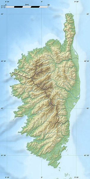
English: Blank physical map of the region of Corsica, France, for geo-location purpose, with distinct boundaries for departments and arrondissements as they are since January 2010.
The former version of the map shows the boundaries as they were until December 2009. Français : Carte physique vierge de la région Corse, France, destinée à la géolocalisation, avec limite distincte des départements et arrondissements tels que depuis janvier 2010. L'ancienne version de la carte montre le découpage administratif tel qu'il était jusqu'en décembre 2009. Scales: 1:520,000 (precision: 130 m) for the topography; 1:7,420,000 (precision: 1,855 m) for the bathymetry
Geographic limits of the map:
|
||
| Datum | 2008-08, modified 02-2010 | ||
| Fons |
Opus proprium
|
||
| Auctor | Eric Gaba (Sting - fr:Sting) | ||
| Permissio (Reusing this file) |
|
||
| Other versions |
|

Potestas usoris
I, the copyright holder of this work, hereby publish it under the following licenses:
This file is licensed under the Creative Commons Attribution-Share Alike 3.0 Unported license.
- Tibi licet:
- communicare – copiare, distribuere et committere hoc opus
- to remix – to adapt the work
- His condicionibus:
- attributio – You must give appropriate credit, provide a link to the license, and indicate if changes were made. You may do so in any reasonable manner, but not in any way that suggests the licensor endorses you or your use.
- aequa parte – If you remix, transform, or build upon the material, you must distribute your contributions under the same or compatible license as the original.

|
Licet hoc documentum exscribere vel distribuere vel demutare sub GNU Liberarum Litterarum Licentiae conditionibus in editione 1.2 aut in ulla editione recentiori a Fundatione Liberarum Programmationis Partium publicata; praeterquam Sectiones Immutabiles et Verba Involucra Adversa et Aversa. Licentiae exemplar praesto est in sectione intitulata GNU Free Documentation License. |
Tibi typum permissionis ligere licet.
Historia fasciculi
Presso die vel tempore fasciculum videbis, sicut tunc temporis apparuit.
| Dies/Tempus | Minutio | Dimensiones | Usor | Sententia | |
|---|---|---|---|---|---|
| recentissima | 13:50, 18 Iulii 2010 | | 824 × 1 625 (324 chiliocteti) | Sting | Color profile |
| 18:33, 22 Februarii 2010 |  | 824 × 1 625 (317 chiliocteti) | Sting | Updated arrondissments boundaries of Haute-Corse | |
| 19:50, 14 Augusti 2008 |  | 824 × 1 625 (315 chiliocteti) | Sting | == Summary == {{Location|42|12|00|N|09|03|00|E|scale:2000000}} <br/> {{Information |Description={{en|Blank physical map of the region of Corsica, France, for geo-location purpose, with distinct boundaries for departments and arrondissement |
Nexus ad fasciculum
Ad hunc fasciculum nectunt:
Usus fasciculi per inceptus Vicimediorum
Quae incepta Vici fasciculo utuntur:
- Usus in als.wikipedia.org
- Usus in ang.wikipedia.org
- Usus in ar.wikipedia.org
- Usus in ast.wikipedia.org
- Usus in bg.wikipedia.org
- Usus in bn.wikipedia.org
- Usus in bs.wikipedia.org
- Usus in ca.wikipedia.org
- Usus in ceb.wikipedia.org
- Usus in cs.wikipedia.org
- Usus in de.wikipedia.org
- Usus in de.wikivoyage.org
- Usus in dsb.wikipedia.org
- Usus in el.wikipedia.org
- Usus in en.wikipedia.org
View more global usage of this file.