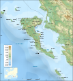
Fasciculus:Corfu topographic map-blank.svg

Sua resolutio(fasciculus SVG, nominale 2 100 × 2 345 elementa imaginalia, magnitudo fasciculi: 2.29 megaocteti)

Hic fasciculus apud Vicimedia Communia iacet; in aliis inceptis adhiberi potest. Contenta paginae descriptionis fasciculi subter monstrantur.

Summarium

Descriptio
English: Blank topographic map of the Corfu island area in Greece.
Français : Carte topographique vierge de la zone de l'île de Corfou en Grèce.
Datum
Fons Own work ;
Background map : NASA Shuttle Radar Topography Mission (SRTM3 v.2) (public domain) edited with 3DEM from Visualization Software LLC and vectorized with Inkscape ; UTM projection ; WGS84 datum ; shaded relief (composite image of N-W, W and N lightning positions) ;
Bathymetry : USGov public domain data provided by the Demis add-on for World Wind (see the approval e-mail) ;
Approximate scale of topographic data and shore / lakes limits : 1:372,000 ; of the bathymetry : 1:3.720.000
Locator map : Image:Europe_countries.svg (modified) created by Júlio Reis under CC-BY-SA ;
Note : The shaded relief is a raster image embedded in the SVG file which increases its size. If you want a lighter map (about 1 120 ko) for other purposes, delete the shaded relief image in your file.
Auctor Eric Gaba (Sting - fr:Sting)
Permissio
(Reusing this file)
Attribution and Share-Alike required
Other versions

[recensere]

SVG genesis
InfoField
 
The SVG code is valid.
 
This map was created with Inkscape.
 
 This map uses embedded text that can be easily translated using a text editor.
 
  This SVG map uses embedded raster graphics to show its topographic structures.

Potestas usoris

I, the copyright holder of this work, hereby publish it under the following licenses:
GNU head Licet hoc documentum exscribere vel distribuere vel demutare sub GNU Liberarum Litterarum Licentiae conditionibus in editione 1.2 aut in ulla editione recentiori a Fundatione Liberarum Programmationis Partium publicata; praeterquam Sectiones Immutabiles et Verba Involucra Adversa et Aversa. Licentiae exemplar praesto est in sectione intitulata GNU Free Documentation License.
w:en:Creative Commons
attributio aequa parte
This file is licensed under the Creative Commons Attribution-Share Alike 3.0 Unported license.
Tibi licet:
  • communicare – copiare, distribuere et committere hoc opus
  • to remix – to adapt the work
His condicionibus:
  • attributio – You must give appropriate credit, provide a link to the license, and indicate if changes were made. You may do so in any reasonable manner, but not in any way that suggests the licensor endorses you or your use.
  • aequa parte – If you remix, transform, or build upon the material, you must distribute your contributions under the same or compatible license as the original.
This licensing tag was added to this file as part of the GFDL licensing update.
w:en:Creative Commons
attributio aequa parte
This file is licensed under the Creative Commons Attribution-Share Alike 2.5 Generic, 2.0 Generic and 1.0 Generic license.
Tibi licet:
  • communicare – copiare, distribuere et committere hoc opus
  • to remix – to adapt the work
His condicionibus:
  • attributio – You must give appropriate credit, provide a link to the license, and indicate if changes were made. You may do so in any reasonable manner, but not in any way that suggests the licensor endorses you or your use.
  • aequa parte – If you remix, transform, or build upon the material, you must distribute your contributions under the same or compatible license as the original.
Tibi typum permissionis ligere licet.

Captions

Add a one-line explanation of what this file represents

Items portrayed in this file

depicts Anglica

copyrighted Anglica

Martius 2007

media type Anglica

image/svg+xml

checksum Anglica

5e872528077f274559549865893b6cd892275ead

data size Anglica

2 397 198 byte

2 345 pixel

2 100 pixel

Historia fasciculi

Presso die vel tempore fasciculum videbis, sicut tunc temporis apparuit.

Dies/TempusMinutioDimensionesUsorSententia
recentissima22:59, 4 Septembris 2008Minutum speculum redactionis 22:59, 4 Septembris 2008 factae2 100 × 2 345 (2.29 megaocteti)StingUsing bathymetry from ETOPO1 ; new standard colors
21:56, 29 Martii 2007Minutum speculum redactionis 21:56, 29 Martii 2007 factae2 100 × 2 345 (2.98 megaocteti)StingLocator map added; bathymetry more detailed
03:12, 26 Martii 2007Minutum speculum redactionis 03:12, 26 Martii 2007 factae2 100 × 2 345 (2.92 megaocteti)StingHidden layers deleted for a really blank map display
23:37, 10 Martii 2007Minutum speculum redactionis 23:37, 10 Martii 2007 factae2 100 × 2 345 (3.05 megaocteti)Sting{{Information| |Description=Blank topographic map of the Corfu island area in Greece. |Source=Own work ;<br/>Background map : [http://www2.jpl.nasa.gov/srtm NASA Shuttle Radar Topography Mission] (SRTM3 v.2) (public domain) edited with [http

Ad hunc fasciculum nectit:

Usus fasciculi per inceptus Vicimediorum

Quae incepta Vici fasciculo utuntur: