Fasciculus:Chad relief location map.jpg

Mensura huius perspectionis: 399 × 599 elementa imaginalia. Aliae mensurae: 160 × 240 elementa imaginalia | 320 × 480 elementa imaginalia | 899 × 1 349 elementa imaginalia.
Sua resolutio (899 × 1 349 elementa imaginalia, magnitudo fasciculi: 197 chiliocteti, typus MIME: image/jpeg)
Summarium
| Camera location | | View this and other nearby images on: OpenStreetMap |
|---|
| Descriptio |
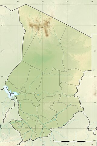
English: Blank physical map of Chad as since the 2008-02 reform of the Regions, for geo-location purposes.
Français : Carte physique vierge du Tchad telle que depuis la réforme des Régions de février 2008, destinée à la géolocalisation. Scale: 1:5,600,000 (precision: 1,400 m)
Geographic limits of the map:
|
||
| Datum | 2009-11, updated 2011-07 | ||
| Fons |
Opus proprium
|
||
| Auctor | Eric Gaba (Sting - fr:Sting) | ||
| Permissio (Reusing this file) |
|
||
| Other versions |
|

Potestas usoris
I, the copyright holder of this work, hereby publish it under the following licenses:
This file is licensed under the Creative Commons Attribution-Share Alike 3.0 Unported license.
- Tibi licet:
- communicare – copiare, distribuere et committere hoc opus
- to remix – to adapt the work
- His condicionibus:
- attributio – You must give appropriate credit, provide a link to the license, and indicate if changes were made. You may do so in any reasonable manner, but not in any way that suggests the licensor endorses you or your use.
- aequa parte – If you remix, transform, or build upon the material, you must distribute your contributions under the same or compatible license as the original.

|
Licet hoc documentum exscribere vel distribuere vel demutare sub GNU Liberarum Litterarum Licentiae conditionibus in editione 1.2 aut in ulla editione recentiori a Fundatione Liberarum Programmationis Partium publicata; praeterquam Sectiones Immutabiles et Verba Involucra Adversa et Aversa. Licentiae exemplar praesto est in sectione intitulata GNU Free Documentation License. |
Tibi typum permissionis ligere licet.
Historia fasciculi
Presso die vel tempore fasciculum videbis, sicut tunc temporis apparuit.
| Dies/Tempus | Minutio | Dimensiones | Usor | Sententia | |
|---|---|---|---|---|---|
| recentissima | 22:21, 14 Iulii 2011 | | 899 × 1 349 (197 chiliocteti) | Sting | Sudan/South Sudan 2011-07 border update |
| 13:20, 19 Iulii 2010 |  | 899 × 1 349 (241 chiliocteti) | Sting | Color profile | |
| 23:26, 23 Novembris 2009 |  | 899 × 1 349 (242 chiliocteti) | Sting | == {{int:filedesc}} == {{Location|15|27|00|N|18|43|30|E|scale:7000000}} <br/> {{Information |Description={{en|Blank physical map of Chad as after the 2008-02 reform of the Regions, for geo-location purposes.}} {{fr|Carte physique vierge du [[ |
Nexus ad fasciculum
Ad hunc fasciculum nectit:
Usus fasciculi per inceptus Vicimediorum
Quae incepta Vici fasciculo utuntur:
- Usus in ar.wikipedia.org
- Usus in azb.wikipedia.org
- Usus in az.wikipedia.org
- Usus in ban.wikipedia.org
- Usus in ba.wikipedia.org
- Usus in bcl.wikipedia.org
- Usus in be-tarask.wikipedia.org
- Usus in be.wikipedia.org
- Usus in bg.wikipedia.org
View more global usage of this file.