Fasciculus:Îles d'Hyères topographic map-fr.svg

Size of this PNG preview of this SVG file: 784 × 337 elementa imaginalia. Aliae mensurae: 320 × 138 elementa imaginalia | 640 × 275 elementa imaginalia | 1 024 × 440 elementa imaginalia | 1 280 × 550 elementa imaginalia | 2 560 × 1 100 elementa imaginalia.
Sua resolutio (fasciculus SVG, nominale 784 × 337 elementa imaginalia, magnitudo fasciculi: 1.84 megaocteti)
Summarium
| Camera location | | View this and other nearby images on: OpenStreetMap |
|---|
| Descriptio |
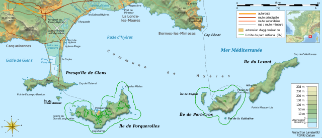
Français : Carte topographique et administrative en français des Îles d'Hyères.
Deutsch: Topographische Karte / Verwaltungskarte zum Îles d'Hyères, in Französische
English: Topographic and administrative map in French language of Îles d'Hyères
Italiano: Carta topografica e amministrativa delle Isole di Hyères (en francese)
|
||
| Datum | (UTC) | ||
| Fons |
Création personnelle ;
|
||
| Auctor | Bourrichon (talk) - fr:Bourrichon | ||
| Permissio (Reusing this file) |
|
||
| Other versions |
Add-your-version : Template:Other versions/Îles d'Hyères map
|


|
This SVG file contains embedded text that can be translated into your language, using any capable SVG editor, text editor or the SVG Translate tool. For more information see: About translating SVG files. |
This W3C-unspecified vector image was created with Inkscape .
Potestas usoris
I, the copyright holder of this work, hereby publish it under the following licenses:

|
Licet hoc documentum exscribere vel distribuere vel demutare sub GNU Liberarum Litterarum Licentiae conditionibus in editione 1.2 aut in ulla editione recentiori a Fundatione Liberarum Programmationis Partium publicata; praeterquam Sectiones Immutabiles et Verba Involucra Adversa et Aversa. Licentiae exemplar praesto est in sectione intitulata GNU Free Documentation License. |
This file is licensed under the Creative Commons Attribution-Share Alike 3.0 Unported, 2.5 Generic, 2.0 Generic and 1.0 Generic license.
- Tibi licet:
- communicare – copiare, distribuere et committere hoc opus
- to remix – to adapt the work
- His condicionibus:
- attributio – You must give appropriate credit, provide a link to the license, and indicate if changes were made. You may do so in any reasonable manner, but not in any way that suggests the licensor endorses you or your use.
- aequa parte – If you remix, transform, or build upon the material, you must distribute your contributions under the same or compatible license as the original.
Tibi typum permissionis ligere licet.
Historia fasciculi
Presso die vel tempore fasciculum videbis, sicut tunc temporis apparuit.
| Dies/Tempus | Minutio | Dimensiones | Usor | Sententia | |
|---|---|---|---|---|---|
| recentissima | 11:40, 23 Augusti 2018 | | 784 × 337 (1.84 megaocteti) | Bourrichon | +extension des limites du parc national : ajout de l'île de Porquerolles |
| 13:53, 19 Augusti 2011 |  | 784 × 337 (1.83 megaocteti) | Bourrichon | == {{int:filedesc}} == {{Location|20|15|00|S|57|35|00|E|scale:500000}} {{Information |Description= {{fr|Carte topographique et administrative en français des Îles d'Hyères.}} {{de|Topographische Karte / Verwaltungskarte zum [[: |
Nexus ad fasciculum
Ad hunc fasciculum nectunt:
Usus fasciculi per inceptus Vicimediorum
Quae incepta Vici fasciculo utuntur:
- Usus in cs.wikipedia.org
- Usus in da.wikipedia.org
- Usus in de.wikipedia.org
- Usus in en.wikipedia.org
- Usus in en.wikivoyage.org
- Usus in fr.wikipedia.org
- Conservatoire du littoral
- Parc national de Port-Cros
- Presqu'île de Giens
- Îles d'Hyères
- Utilisateur:Flappiefh/Bac à sable/Images à améliorer/Contenu visiteur
- Wikipédia:Atelier graphique/Cartes/Archives/septembre 2011
- Rade d'Hyères
- Wikipédia:Atelier graphique/Cartes/Archives/octobre 2016
- Golfe de Giens
- Usus in fr.wiktionary.org
- Usus in ja.wikipedia.org
- Usus in nn.wikipedia.org
- Usus in oc.wikipedia.org
- Usus in pl.wikipedia.org
- Usus in pt.wikipedia.org
- Usus in ru.wikipedia.org
- Usus in www.wikidata.org
- Usus in zh.wikipedia.org
- Usus in zh.wikivoyage.org