Fasciculus:Sweden Kalmar location map.svg

Size of this PNG preview of this SVG file: 327 × 599 elementa imaginalia. Aliae mensurae: 131 × 240 elementa imaginalia | 262 × 480 elementa imaginalia | 419 × 768 elementa imaginalia | 559 × 1 024 elementa imaginalia | 1 118 × 2 048 elementa imaginalia | 546 × 1 000 elementa imaginalia.
Sua resolutio (fasciculus SVG, nominale 546 × 1 000 elementa imaginalia, magnitudo fasciculi: 217 chiliocteti)
Summarium
| Descriptio |
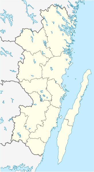
English: Location map of Kalmar County in Sweden. N-S stretching is 183%, geographic limits of the map:
Deutsch: Positionskarte von Kalmar län in Schweden. N-S-Streckung beträgt 183%, geographische Begrenzung der Karte:
|
| Datum | |
| Fons | Opus proprium |
| Auctor | Erik Frohne |
| Other versions | Derivative works of this file: Öland Municipal centres.svg |
Potestas usoris
I, the copyright holder of this work, hereby publish it under the following licenses:

|
Licet hoc documentum exscribere vel distribuere vel demutare sub GNU Liberarum Litterarum Licentiae conditionibus in editione 1.2 aut in ulla editione recentiori a Fundatione Liberarum Programmationis Partium publicata; praeterquam Sectiones Immutabiles et Verba Involucra Adversa et Aversa. Licentiae exemplar praesto est in sectione intitulata GNU Free Documentation License. |
This file is licensed under the Creative Commons Attribution 3.0 Unported license.
- Tibi licet:
- communicare – copiare, distribuere et committere hoc opus
- to remix – to adapt the work
- His condicionibus:
- attributio – You must give appropriate credit, provide a link to the license, and indicate if changes were made. You may do so in any reasonable manner, but not in any way that suggests the licensor endorses you or your use.
Tibi typum permissionis ligere licet.
Historia fasciculi
Presso die vel tempore fasciculum videbis, sicut tunc temporis apparuit.
| Dies/Tempus | Minutio | Dimensiones | Usor | Sententia | |
|---|---|---|---|---|---|
| recentissima | 08:23, 27 Ianuarii 2009 | | 546 × 1 000 (217 chiliocteti) | Erik Frohne | Waterline adjusted |
| 16:26, 18 Ianuarii 2009 |  | 546 × 1 000 (216 chiliocteti) | Erik Frohne | Added some lakes Category:Location maps of Sweden | |
| 09:58, 17 Ianuarii 2009 |  | 546 × 1 000 (183 chiliocteti) | Erik Frohne | {{Information |Description={{en|1=Location map of Kalmar in Sweden. N-S stretching is 183%, geographic limits of the map: * N: 58.20° N * S: 56.10° N * W: 15.10° E * E: 17.20° E }} {{de|1=Positionskarte von Kalmar in Sweden. N-S-Streckung beträgt 18 |
Nexus ad fasciculum
Ad hunc fasciculum nectit:
Usus fasciculi per inceptus Vicimediorum
Quae incepta Vici fasciculo utuntur:
- Usus in ar.wikipedia.org
- Usus in arz.wikipedia.org
- Usus in bg.wikipedia.org
- Usus in ca.wikipedia.org
- Usus in ceb.wikipedia.org
- Usus in cs.wikipedia.org
- Usus in da.wikipedia.org
View more global usage of this file.