Fasciculus:Devon UK location map.svg

Size of this PNG preview of this SVG file: 653 × 600 elementa imaginalia. Aliae mensurae: 261 × 240 elementa imaginalia | 523 × 480 elementa imaginalia | 836 × 768 elementa imaginalia | 1 115 × 1 024 elementa imaginalia | 2 229 × 2 048 elementa imaginalia | 1 292 × 1 187 elementa imaginalia.
Sua resolutio (fasciculus SVG, nominale 1 292 × 1 187 elementa imaginalia, magnitudo fasciculi: 2.43 megaocteti)
| Descriptio |
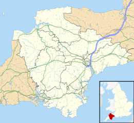
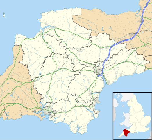
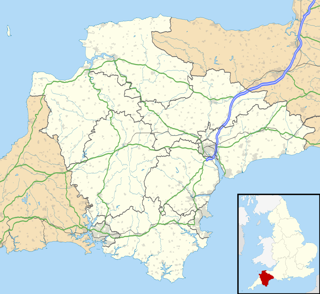
Map of Devon, UK with the following information shown:
Equirectangular map projection on WGS 84 datum, with N/S stretched 150% Geographic limits:
|
| Datum | |
| Fons |
|
| Auctor | Nilfanion, created using Ordnance Survey data |
| Permissio (Reusing this file) |
This file is licensed under the Creative Commons Attribution-Share Alike 3.0 Unported license. Attributio: Contains Ordnance Survey data © Crown copyright and database right
|
| Other versions | File:Devon UK district map (blank).svg - Blank map with administrative borders only. |
.svg)
Historia fasciculi
Presso die vel tempore fasciculum videbis, sicut tunc temporis apparuit.
| Dies/Tempus | Minutio | Dimensiones | Usor | Sententia | |
|---|---|---|---|---|---|
| recentissima | 18:48, 26 Septembris 2010 | | 1 292 × 1 187 (2.43 megaocteti) | Nilfanion | tweak motorways... |
| 23:56, 6 Septembris 2010 |  | 1 292 × 1 187 (2.64 megaocteti) | Nilfanion | Tweaking urban areas, road colours and boundary lines | |
| 20:54, 4 Septembris 2010 |  | 1 292 × 1 187 (2.4 megaocteti) | Nilfanion | {{Information |Description=Map of Devon, UK with the following information shown: *Administrative borders *Coastline, lakes and rivers *Motorways and primary routes *Urban areas Equirectangular map projection on WGS 84 datum, with N/S stretch |
Nexus ad fasciculum
Ad hunc fasciculum nectunt:
- Apultrea
- Ashburton
- Axeminstra
- Axmouth
- Bathentona
- Bediforda
- Bera (Devonia)
- Bere Alston
- Boclanda Monachorum
- Bovey Tracey
- Bradninch
- Brantona
- Brendon
- Brixham
- Broadclyst
- Broadhembury
- Buckfastleigh
- Budleigh Salterton
- Buffestra
- Burrington (Devonia)
- Chagford
- Chardstock
- Cheriton Bishop
- Chudleigh
- Chulmleigh
- Clovelly
- Combe Martin
- Croyde
- Culintona
- Cullompton
- Culmstock
- Devonport
- Exmouth
- Great Torrington
- Halwell
- Hatherlega
- Hertilanda
- Holsworthy
- Honiton
- Horrabridge
- Ilfracombe
- Kingsbridge
- Kingswear
- Lydford
- Lynmouth
- Lynton
- Modberia
- Moretonhampstead
- Newton Abbot
- North Molton
- North Tawton
- Northam (Devonia)
- Ochamentona
- Ottery Sanctae Mariae
- Peintona
- Plympton
- Pons Hederosus
- Princetown (Devonia)
- Salcombe
- Seaton (Devonia)
- Sheepwash (Devonia)
- Sideberia
- Sidmouth
- South Molton
- Taintona Drue
- Taintona Episcopi
- Taintona Regis
- Tivertonia
- Topsham
- Uffculme
- Westward Ho! (Devonia)
- Widecumba
- Woolacombe
- Woolfardisworthy
- Yelverton (Devonia)
- Formula:Charta locatrix Devoniae
- Formula:Charta locatrix Devoniae physicalis
Usus fasciculi per inceptus Vicimediorum
Quae incepta Vici fasciculo utuntur:
- Usus in ar.wikipedia.org
- Usus in arz.wikipedia.org
- Usus in azb.wikipedia.org
- هونیتون
- هولسوورتی، دوون
- هارتلند، دوون
- هاترلی، دوون
- نیوتون آبوت
- نورث تاوتون
- نورتهام، دوون
- مورتونهامپستید
- کینقزبریج
- کولیتون، دوون
- کردیتون
- کالومپتون
- قریت تورینقتون
- سیدموث
- سیتون، دوون
- ساوت مولتون
- سالکومب
- دونپورت، پلیموث
- داولیش
- دارتموث، دوون
- چالملی
- چاقفورد
- چادلی
- تیورتون، دوون
- تینموث
- تورکی
- توتنس
- تاویستوک، دوون
- پینتون
- پلمپتون
- بیدفورد
- بووی تریسی
- بودلی سالترتون
- بریکسهام
- برانسکومب
- برادنینچ
- باکفستلی
- بارنستاپل
- آیویبریج
- ایلفراکم
- اوکهامپتون
- اوتری سنت ماری
- اکسمینستر
- اکسموث
- اشبورتون، دوون
- Usus in bg.wikipedia.org
View more global usage of this file.